The natural beauty of Lofoten, part 2
his is part 2 of our blog about the spectacular Lofoten Islands. In this part we will detail our favourite places that we have visited several times during our stay here, amongst them a few hidden gems that are not widely known.
Årstein
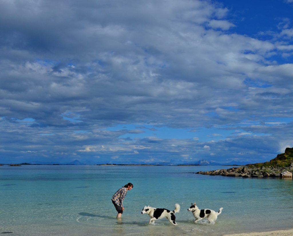
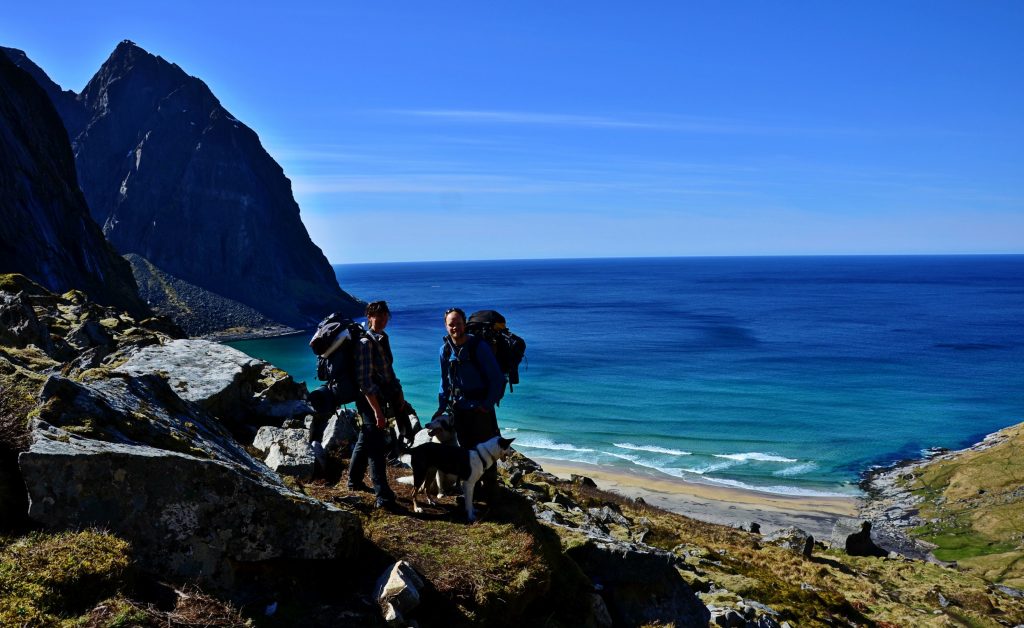
On the way out to Lofoten, you will pass a road leading out to a place called Digermulen. This small village is fairly unremarkable, apart from a ferry that will take you to an island called Storemolla, with stunning mountains and good fishing, There’s even a peak there with its own statue of Jesus Christ. But, the gem we want to talk about, is past Digermulen. Continue the road through the village, and you will find a sign to Årstein. Not many tourists find their way here, as the road is very narrow, but it’s worth it. There’s a white sand beach reminiscent of the Caribbean in summer weather, and a nice, easy hike up to a peak nearby with a beautiful view.
Liland
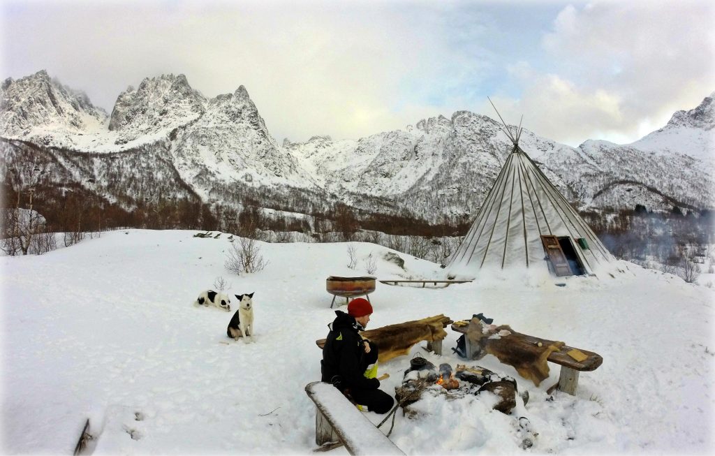
About 30 minutes before reaching Svolvær you can turn off the main road and out to this place. At the end of the road there’s a few parking spots. Follow the road past the parking and past the gate, continue along the trail, and you will end up at an idyllic site, complete with a permanent Lavvu (a huge tent) and an outside and inside fireplace. Perfect for a relaxing Sunday stroll.
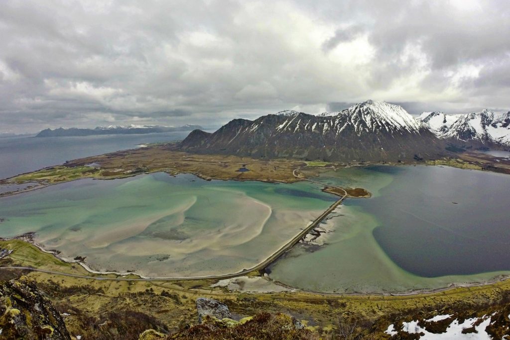
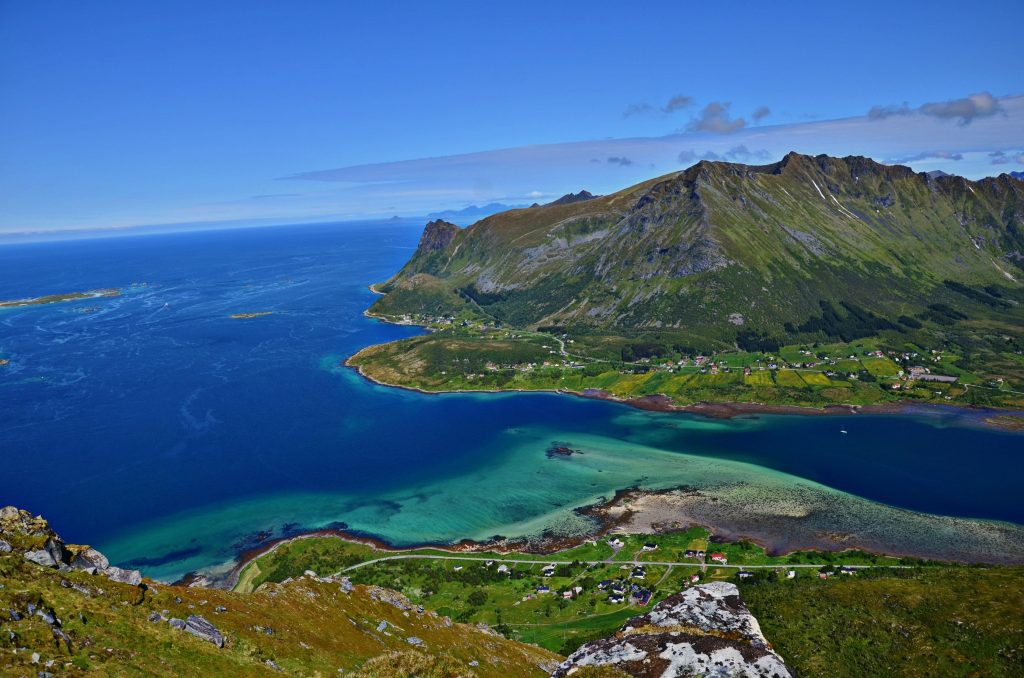
Delp and the surroundings
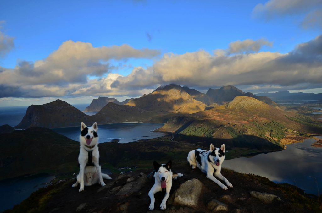
A few kilometers down the road after getting back on the E10 from Liland, you will come to a sharp left turn across a stone bridge. This spot in itself might be a nice place to stop, but there also a side road going to a place called Laukvika here, which will lead you to the next point on our list. Follow the road all the way to Laukvika, then take a left when you have to choose, and follow it for another 2,5 km. Here, hidden in the woods on your right should be a flat open area to park, as well as a sign saying “Matmora”. The trail you will follow here is a bit steep, but still manageable for most. We never went all the way to Matmora, but would keep to the plateau just after the trail stops climbing, as the view from here is absolutely stunning. We’ll let the picture speak for itself.
For those not wishing a hike, there’s a very nice walk that starts just before the bridge you see in the above pictures. It’s a nice forest road that will take you to the beginning of a series of lakes. Mind the sheep in summer though, and keep any dogs on a leash.
Vaterfjord
Getting back to the E10 and continuing towards Svolvær, eventually you will get to a bridge crossing a strong current. This place is called Vaterfjord, and there’s a few possibilities here. You can either park on either side of the bridge, and then follow a trail that runs on the right hand side of the fjord, or park on any of the possible spots further along the road and then head up to the hills between you and the sea. The trail along the fjord is a nice, peaceful walk along a well worn trail (just beware that it does get a bit wet in some places), while the hills will give you a very nice view of the spectacular mountains of Store Molla.
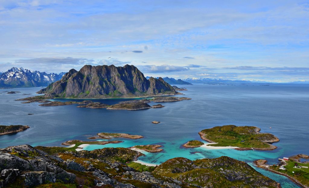
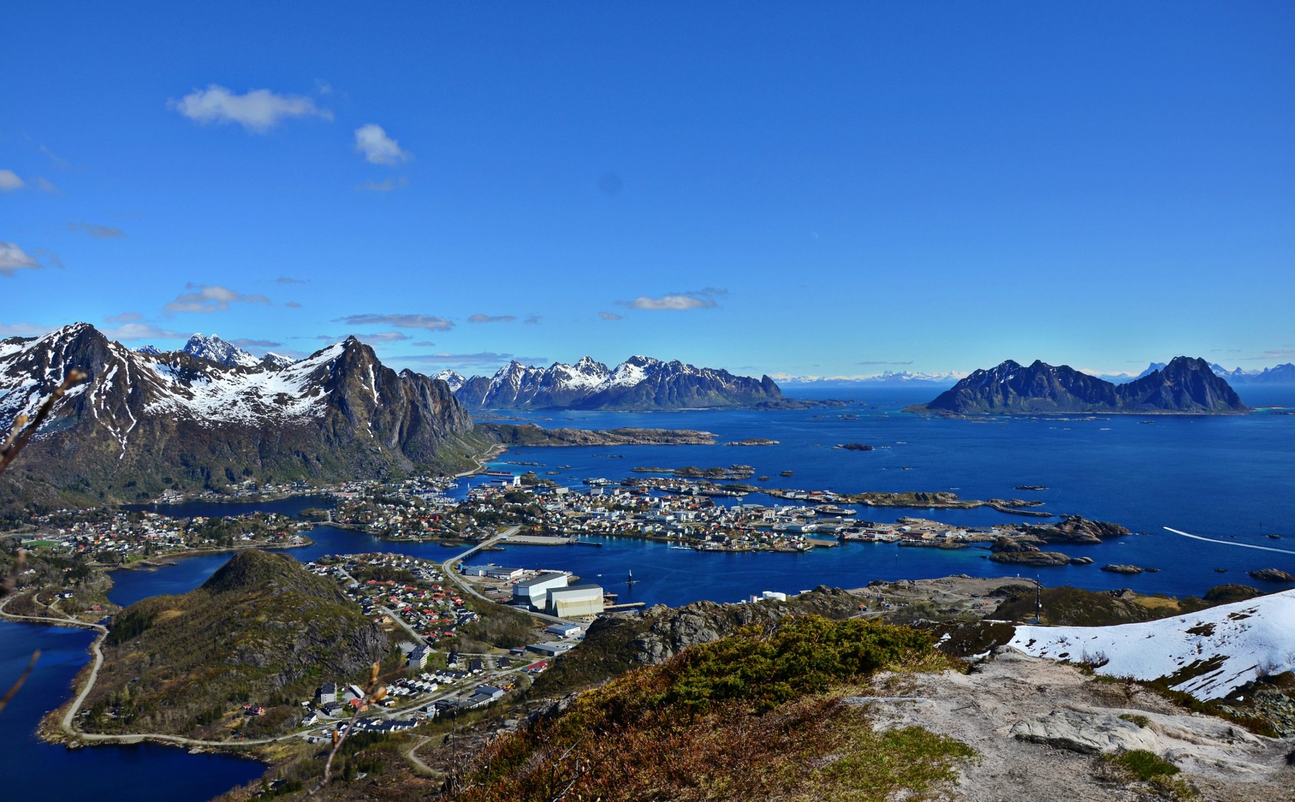
Skrova
Alright, so you have finally reached Svolvær. What we neglected to mention in part 1 was the ferry leading out to Skrova, a small island visible from the town itself. The ferry takes about 20 minutes, and it lets you off in a cosy little village with its own natural harbour. The village itself offers some accommodation and places to eat, as well as a beautiful hike to the top of the local mountain. Here you will get a marvellous view of Svolvær, all the way to Henningsvær on a good day, as well as Store and Lille Molla. Plan the ferries ahead though, they change slightly with the season.
Glomtinden (419 m.a.s) and the Old Road
Now it’s time to start leaving Svolvær and the surroundings behind, and head west. On the way there, you will come to a round valley with two lakes and a tunnel in the end, and here you will find one of the most popular hiking trips in this part of Lofoten. This trail is actually the old road going west, with a wide, easy path starting on both sides of the tunnel with plenty of parking. Heading up to the pass above the tunnel is an easy stroll with a very nice view on both sides, and at the top you will find a well-trodden trail heading towards Glomtinden. This part of the trail is fairly steep in two places, but take it easy and you will soon be rewarded with a stunning view from the top.
Henningsvær
This is one of the more popular places to visit in Lofoten. It’s a tiny village nestled on several small islands, and as a result the streets are quite narrow. Home to many artists and photographers, this place also houses the Climbing Café, as the mountains just outside are brimming with paths for people try out. Having lived here for two years, we can safely say that summer is not the best time to visit. The road out here are quite narrow, and a 7-minute drive for locals easily stretches to 30 minutes when there are 15 caravans navigating it. There are several places offering accommodation, as well as several art galleries.
Kleppstadheia (534 m.a.s)
After a visit to Glomtinden, we keep going west. There’s still much to see. Roughly 25-30 minutes drive from Svolvær you’ll come to a place called Kleppstad, and just as you leave it there’s a bus stop on the right. Turn in there, and there’s a few parking spots next to a sheep gate. The trail is easy in the beginning, but once you clear the treeline, it starts getting steep. It’s not particularly difficult, just take your time, and once you reach the top, you will be rewarded with a spectacular view.
Vikjorda
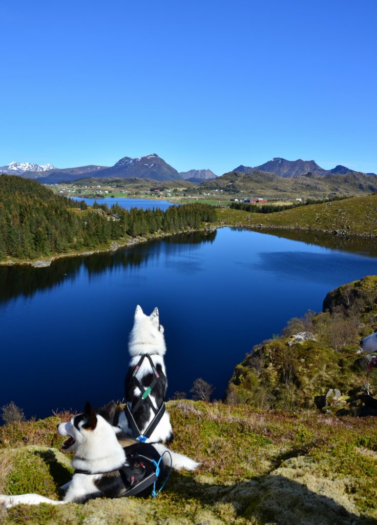
This one is definitely one of our favourites in Lofoten. Just after crossing the second bridge from Svolvær, there’s a road heading off to the left with a sign towards Valberg. This road is an alternative road if you’re heading towards Leknes, and in our opinion it’s the one with the best view, although it’s much narrower and difficult to drive. Along this road though, you will encounter a small place called Vikjorda. Keep driving till you get to the last building on your right, which is a small café. If it’s open and you stop for a coffee, you can park here and follow a trail that starts behind it, or park on the left 150 m down the road (there’s a trail just across the road from the parking lot). The first you will encounter is a large lake, with a fireplace on the opposite side, and if you choose to continue the trail, you can climb further and end up at a second, smaller lake. We loved this place because of the peace, we rarely met other people here, and because of the change in scenery.
Holandsmælen (434 m.a.s)
When looking for what to see in Lofoten, it’s almost inevitable that the famous Haukland Beach will pop up, along with the peaks Mannen and Himmelstinden. We want to show you an alternate hike though, and that’s Holandsmælen. To get there, search for it on Google Maps, and you will find the site for the parking. The trail itself varies, starting out fairly steep up through the forest, but soon flattening out and following the gentle curves of the terrain upwards. The last bit is steep again, with the very top being flat and windblown. What you do get from this hike is a beautiful climb, followed by a stunning view of the different beaches around Haukland in one direction, and an almost alpine landscape the other way.
Kyllingdalen
Before continuing towards the end of Lofoten, there’s one quick detour we’d like to show you, and for that we have to go to Ballstad. Once you get to the beginning of this village you will see a small, red school on your right, and here you can park the car. Head back out to the road and follow the pedestrian path 250m back towards Leknes, and then take the small road on the left into the hills. This path is very easy to follow, and a very nice break from all the previous hiking. There’s a series of lakes, with a small place at the end for a fire and some coffee. We like this place because it’s different from the other scenery in Lofoten, more akin to the inland, and it can be a nice change of pace.
Offersøykammen (436 m.a.s)
Leaving Ballstad behind, we head back until we reach the E10 again and continue west towards Reine and Å. Shortly after getting back on the E10, you will come to a bridge with a strong current running underneath, and just after crossing it, there will be a small road heading left, which we will take. Here, towards the end, there will be a small, round parking lot, and a trail that heads up to and crosses the E10. This is the trail to Offersøykammen.
The trail leading up here is pretty steep most of the way, and we advise caution if it’s been raining, but the view will definitely be reward enough for the struggle. Because of the landscape here as well, with the right weather conditions you can get a so-called inversion, with fog covering the landscape like a white, fluffy blanket.
The Lofoten hotspots
Up till now we’ve taken you on a tour of all our favourite places in Lofoten that the mainstream tourists tend not to visit. That’s part of why we like them, the peace and quiet of being mostly alone in beautiful nature. Now though, to finalize this blog, we’ll do a quick summary of the popular places, starting with Gimsøya and Hoven (368 m.a.s) Gimsøya is a small island with one small settlement in the north. What makes this place interesting is the landscape: It’s more or less flat as a pancake, apart from Hoven poking out of the ground like someone dropped a bucket of soil millennia ago. There’s a trail going up there as well, starting from the golf court that’s been established here. It’s an easy hike that’s very rewarding.
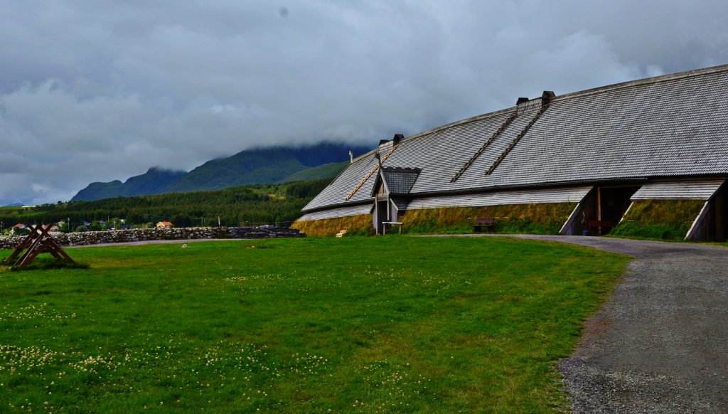
Just before reaching Leknes, there’s a small village called Borg. This place is famous for the Lofotr Viking Museum, an 80 m long reconstructed Long House from the Viking Age, which used to be a chieftain’s seat. In august there’s a festival here with craftsmen from many places in Europe, but it’s well worth the visit any time of year.
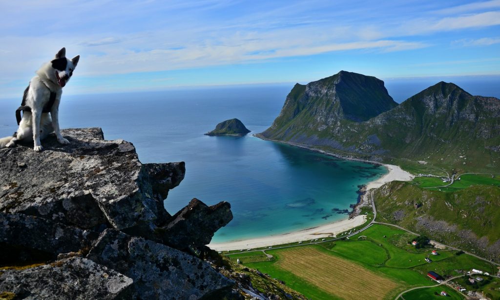
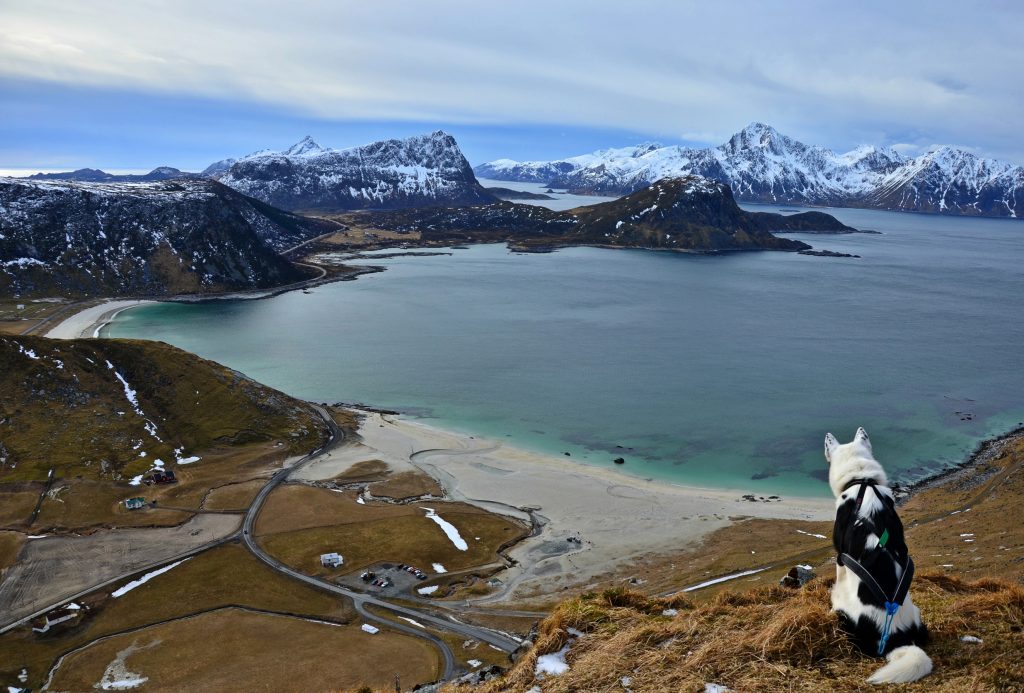
Next up is the Haukland beach and the Mannen peak (400 m.a.s). These two are some of the most popular places in all of Lofoten, the beach because it’s a very nice place, and the peak because it offers a magnificent view of said beach, as well as being a very interestingly shaped peak. It’s not very high, nor very steep, but it might not be suited for you if you have a fear of heights, as it’s quite narrow. There’s also the old road between Haukland and Uttakleiv, which offers a nice relaxing walk.
Heading out to the end of Lofoten, you’ll pass the villages of Flakstad and Ramberg, and then you can exit the E10 out to Fredvang. Just past this place is the trail heading over to Kvalvika, a hidden gem of a beach. The trip across can be a bit daunting, but it’s well worth the visit. Here you can also find a small cabin built from driftwood and trash, constructed by two filmmakers that spent 9 months here. Overlooking the beach is the peak Ryten (543 m.a.s), which is an easy hike compared to most of the other entries here. It offers a brilliant view of Kvalvika, as well as the vast expanse of the North Sea.
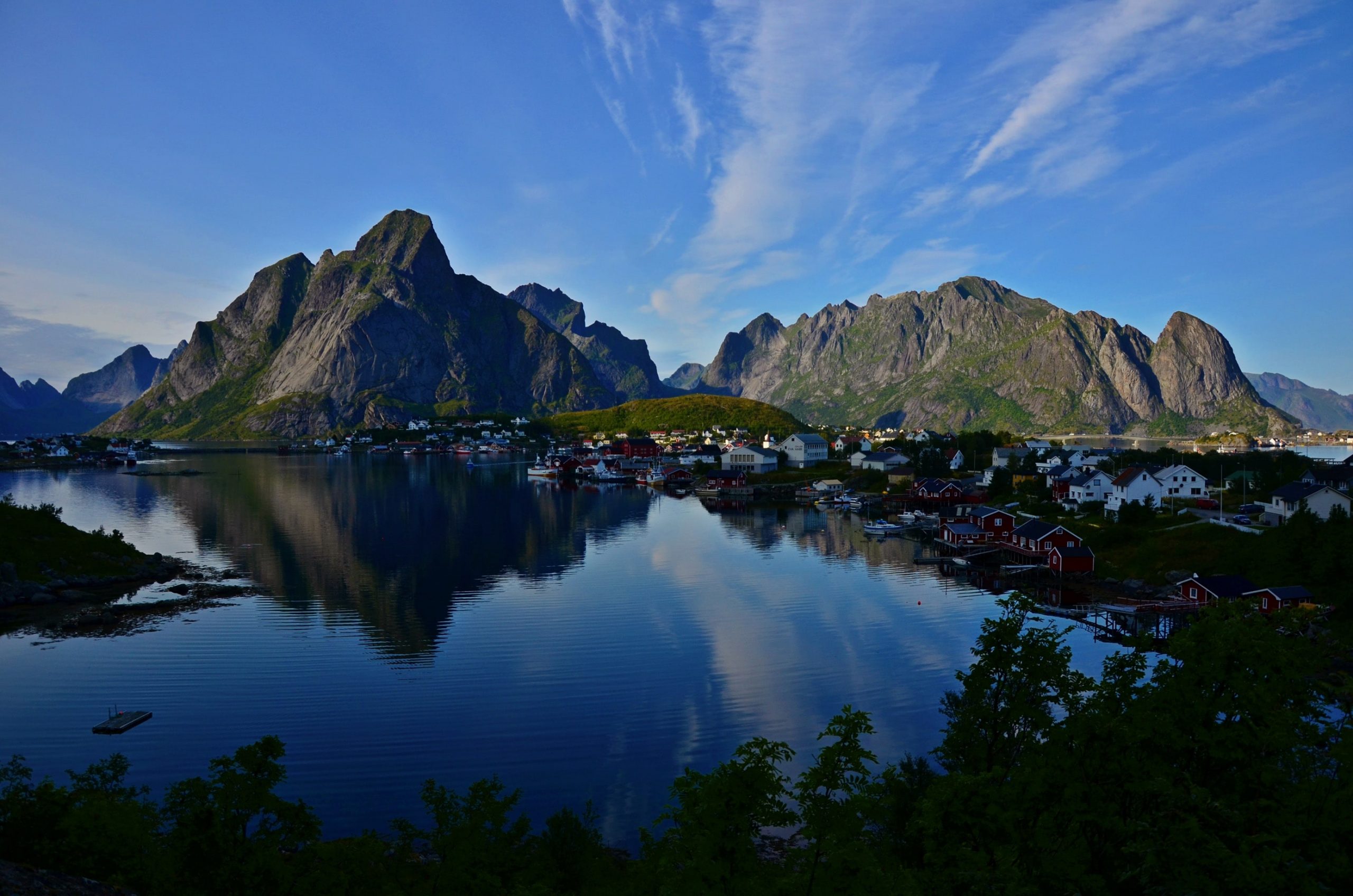
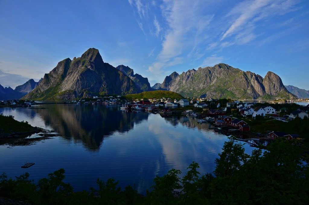
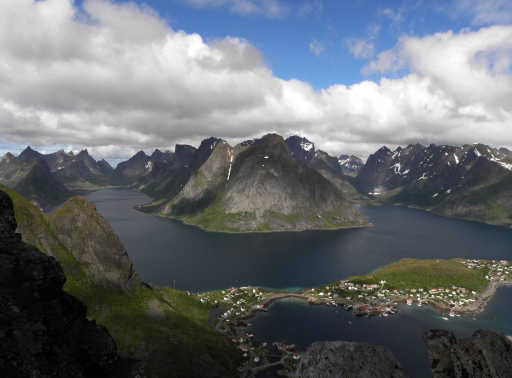
And last, but definitely not least, we come to Reine and Reinebringen (448 m.a.s). Reine itself is an old fishing village, and there’s plenty of opportunity here to go fishing with a captain if that’s your fancy. It’s a special place because of it’s location and a big tourist magnet, and the same goes for the peak that hovers over it. Reinebringen is iconic when it comes to Lofoten, but it’s definitely not for the inexperienced hiker. The trail up is steep and slippery, and although Nepalese Sherpas have been hired in to improve the trail, we still only recommend this hike for anyone in good shape, used to hiking and who owns a proper pair of hiking shoes.
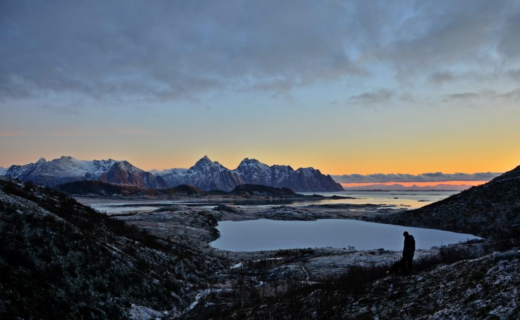
That sort of wraps up our guided tour of these amazing islands. They are as wild as they are stunning, and have been an inspiration to artists for ages, and probably will be for a long time. If you do plan on going here, do consider all that we have covered in this blog. Travelling here will be a gamble when it comes to the weather, but sometimes the harsh climate will offer fantastic experiences, no matter whether the sun is shining or a storm blows the roof clean off a neighbouring building (that happened to us during our first winter here actually). We hope we’ve managed to give a good insight into this place, and that we have inspired some of you to visit one day.
Leave a Reply